Heʻeia (PC: Aimee Sato)
Publications
Chua, Louis and Winter, Kawika and Oleson, Kirsten, (2026) Environmental-Economic Accounting, Extinction Risk, and Financing: A SEEA EA Application for Forest Ecosystems in Hawaiʻi.(pre-print) Available at SSRN: link
Select Graphics
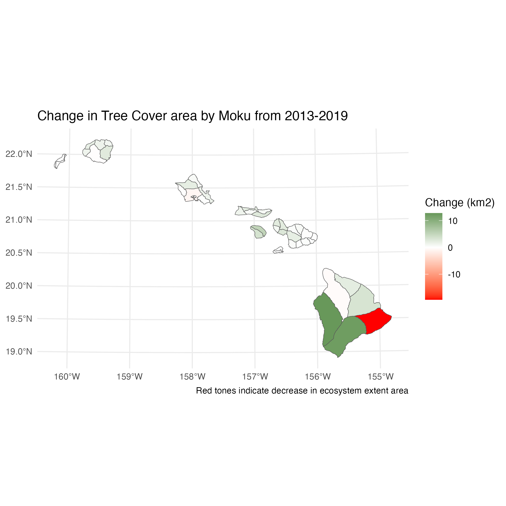
Ecosystem extent account for Tree Cover ecosystem type (change):
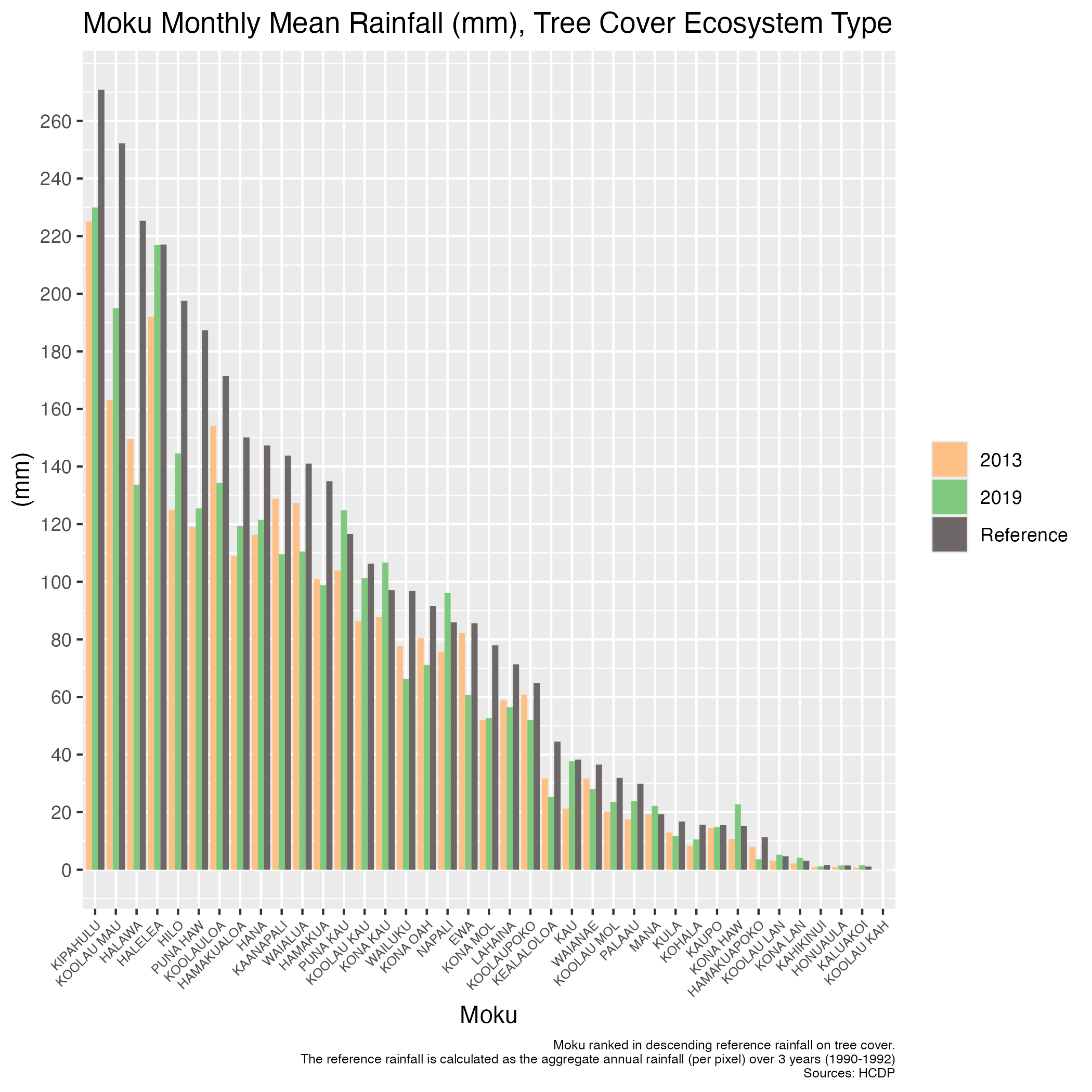
An ecosystem condition account for Tree Cover ecosystem type:
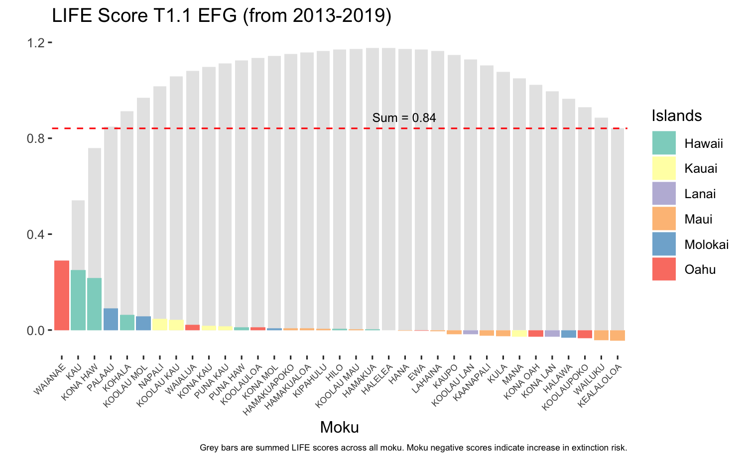
Extinction Risk, LIFE Score for IUCN Ecosystem functional group T1.1 (lowland forests):
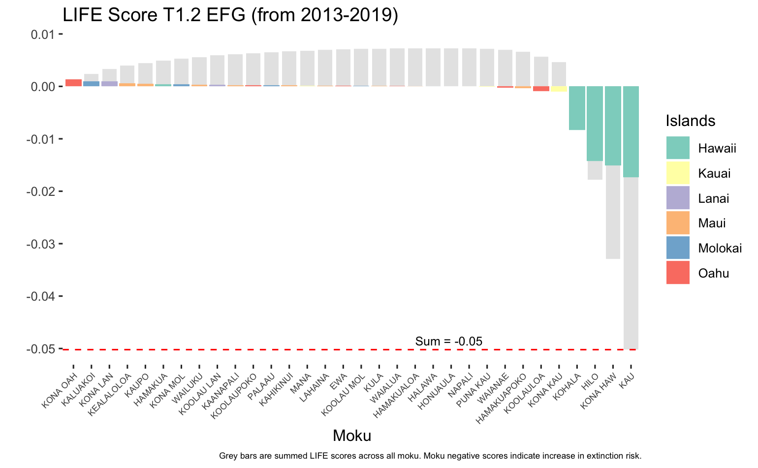
Extinction Risk, LIFE Score for IUCN Ecosystem functional group T1.2 (dry forests & thickets):
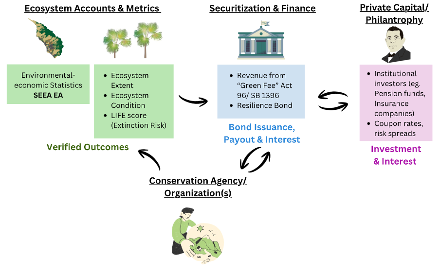
Financing mechanism example of environmental impact bond, using accounting metrics: